


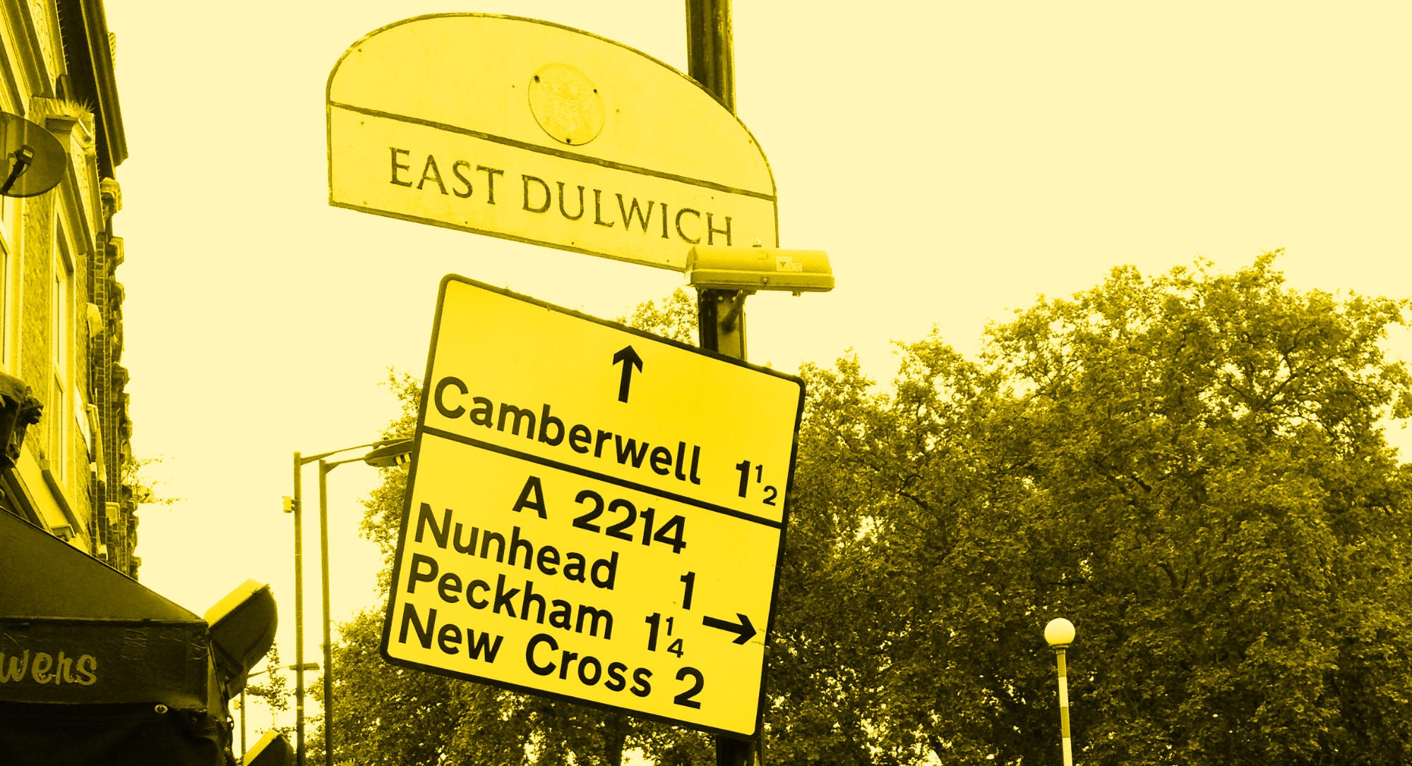
I’ve been away this summer, and I’ll be writing again soon. In the meantime please enjoy this piece I originally wrote for London Reconnections in 2015. This is the story of the “Through Routes” programme - the last great attempt to make London’s streets make sense.
London is a maze. Only the very newest parts of its vast urban sprawl were ever planned in any meaningful sense. Even when the city was small by today’s standards, remaining largely within its Roman walls, the streets were often narrow, winding and looked much like each other. Today, with traffic often nose-to-tail and any number of one-way systems removing all prospect of taking a direct route, it remains difficult to navigate.
But there was, once, a scheme to change that - to create order from the tangle, by signposting routes through and around London logically, consistently and clearly. Those signs are almost all gone, but their influence remains if you know where to look. Their story starts in the 1940s.
Abercrombie’s new London
London’s devious and patternless form was expected to be swept away by bold reconstruction at the end of the Second World War. While the bombs were still falling, the London County Council (LCC) and the Ministry of Works enlisted the eminent planner Patrick Abercrombie to plan for peacetime, a commission that led to the County of London Plan and then the Greater London Plan. These were vast, comprehensive proposals for the transformation of the whole urban area to correct its many deficiencies.
Central to those plans was the reorganisation of the road network, with the creation of new major roads to channel traffic and keep it away from residential and shopping areas. London’s roads would be fit for purpose, logical and direct; navigation would be simple. But when the war ended it became clear that the urgent need for homes and schools would command all the available funding. Even if the money had been available, it’s likely that the planning apparatus of the 1940s would have been almost incapable of implementing something on the vast scale that Abercrombie had originally envisioned.
In 1946, the LCC attempted to make some progress by scaling back its ambitions. Rather than the whole complex road network, it proposed starting with just one route, the “Arterial ‘A’ Ring”, a single motorway-style Inner Ring Road1.
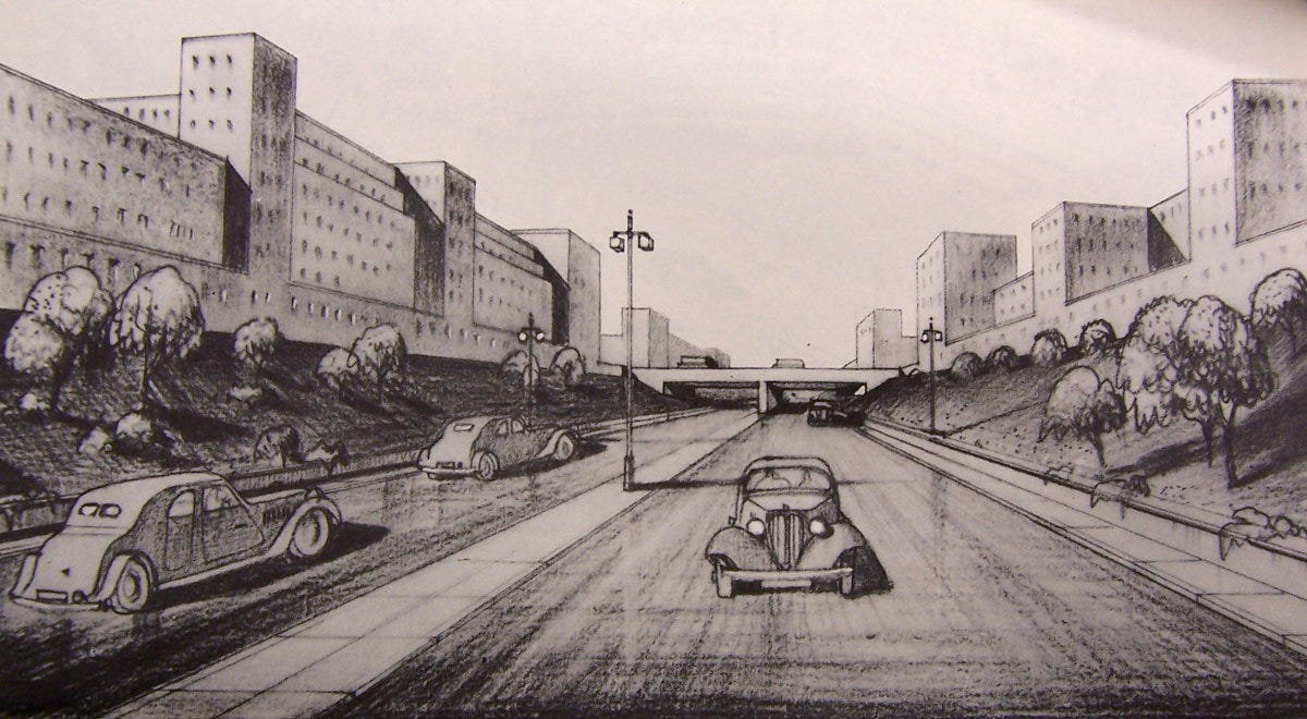
The proposal was not well received. A Parliamentary Committee refused to give the LCC the power to safeguard the line of its new road, and the Minister of Transport, Alfred Barnes, refused to fund it. In private, even its creators had its doubts about the likelihood of it ever being built2.
“After planning the ‘A’ Ring we came to the conclusion that it was completely impossible as an urban motorway largely on economic grounds”.
- Patrick Abercrombie
The death of the ‘A’ Ring marked the end of immediate post-war ambitions for major road-building in London. New roads remained off the agenda for the next fifteen years. But the traffic problem hadn’t gone away, and car ownership was soaring. Having recovered from the wartime slump in traffic levels, by 1950 the number of cars on the roads had actually doubled compared to the years just before the war. With or without new roads, an effective way to move traffic around and through the capital was required.
To the South Bank and the Festival
The situation was brought into sharp focus by events unfolding along the Thames. While a ration-book version of Abercrombie’s masterplan was being started in earnest, Clement Attlee’s government was preparing for the Festival of Britain. The celebration of culture, achievement and a brighter future would be centred on the South Bank and would draw unprecedented numbers of visitors for the whole summer of 1951. Many of those travelling to London would be coming by road, and it was all too obvious that, once there, they would find themselves falling prey to its traffic jams and lost in its illogical streets. Something needed to be done3.
“The Minister is anxious, now that the London ‘A’ Ring has been dropped, to see what can be done to improve the traffic flow.”
- Internal Memorandum, Ministry of Transport
Alfred Barnes, Minister of Transport, was the man faced with solving these problems. With new roads off the table, he came up with a different policy – to make more effective use of the roads London already had.
The flow of traffic was to be improved by designating “Through Routes” for motorists to follow. Main roads and ring roads would be selected for directness and speed, and, most importantly of all, equipped with a consistent city-wide system of signposting. Routes would be found for traffic to avoid travelling through the central area. London would be made logical.
The idea that this was radical thinking may be difficult to grasp today. To put it into context, we need to look at the state of the signposts that faced motorists as they braved London’s roads in 1950.
The Ministry of Transport had standard designs for direction signs, so most signs were serviceable in appearance. Main roads had been classified for nearly 30 years, with A- and B-road numbers well established. But all of this was largely academic, because on the streets themselves, few signs existed - and those that did were often unhelpful.
The reason for this was the war. Most direction signs had been taken down when fear of a German invasion had been at its height. Many more had been damaged by bombing and not replaced. And those that did exist, whether pre- or post-war, had been erected with no overarching policy for selecting destinations, so there was usually no consistency from one junction to the next. At some junctions, repeated attempts to signpost useful destinations led to sign clutter on an incredible scale, while at the next crossroads there might be nothing.
Most signs pointed the way in or out of central London, and few offered opportunities to travel between the suburbs or bypass the City and West End. The only ring road of any consequence in 1950 was the North Circular, which ran in fits and starts from Gunnersbury to Gants Hill; in several places the gaps in its 1920s and 30s dual carriageway were plugged by existing streets. The South Circular Road didn’t really exist, the name principally referring to pre-war proposals for a new road matching the North Circular that had never been built. While the A205 was signposted across some of South London, it wasn’t in any meaningful sense a ring road.
The two Circulars didn’t even meet to form the circle that their name implied. The A205 began at Shepherd’s Bush, several miles along the A40 from the North Circular, and finished at Woolwich, leaving a lengthy gap from there to Gants Hill where no attempt had been made to join them up at all. There were no other ring roads, except the North Orbital Road, an incomplete attempt at 1930s road building that ran only from Watford to Hatfield.
Because there was no way round, long distance traffic that wanted to get from one side of London to the other would commonly just pass straight through the middle, and this was positively encouraged. Central London was far more navigable than the suburbs: the streets in the centre were generally wider and better equipped for heavy volumes of traffic, and the routes in and out were more obvious and better signposted.
Nothing highlighted this seemingly counter-intuitive focus on the centre more than some of the signage that could be found in the heart of London at the time. In 1948, the Ministry of Transport had erected long-distance signs on routes between London and the major ports of Dover, Southampton and Harwich. These signs covered the long journey cross-country, and then doggedly continued right in to the very heart of the city.
“[Signs have been] specially erected to tell us that Tottenham Court Road leads to Harwich, which, at the relevant point, is marked as being 77 miles away. It is curious how few people who live or work in this part of Tottenham Court Road have noticed their new association with Harwich. Many refuse to believe it until the gleaming white and green signpost is pointed out to them.”
- The Times, 22 August 1951
At least the Ministry’s signs had a clear goal. Many ordinary road signs were not erected by the Ministry or the Boroughs at all. Until the 1960s the AA and RAC’s signs were officially recognised and, nationwide, they had designed, installed and paid for a sizeable proportion of all Britain’s direction signs. Unfortunately, while their designs conformed to the Ministry of Transport’s standards, their text often did not, and the two motoring organisations each had their own ideas about which destinations ought to be used. At best their signs were inconsistent; at worst, they were directly in conflict with each other’s and the Ministry’s efforts. In East London, they chose – and signposted – their own completely different route for the North Circular.
Even the Festival itself was contributing to the chaos. Its organisers had already erected special purple signs intended to help motorists from outside London. Inbound, they pointed the way to the two main sites on the South Bank and at Battersea. On the rear face of the sign panel, and therefore usually on the wrong side of the road for traffic trying to leave London, they just read “Exit North” or “Exit West” – not the most helpful of legends.
Enter Alfred Barnes, and his quest for a logical system.
From nothing, a system
On 20 June 1950, Alfred Barnes’ former chauffeur, Mr. Beardon, was probably a little bemused at finding himself summoned back his old employer’s office at the Ministry of Transport. His confusion likely didn’t end there, because after pleasantries had been exchanged, he found himself bombarded with questions.
Calmly and systematically Barnes asked him how he would go about getting to different points in London from various directions, and had a civil servant take detailed notes. Beardon’s suggestions – dozens of them, recorded street by street as he sat in the Minister’s office and recited them - became the utterly unscientific first step in selecting the main roads that the Ministry signposted. They still form the basis for many routes that London’s traffic uses today.
Beardon’s list was circulated to the Divisional Road Engineer for London and the Ministry’s Chief Engineer, and the business of turning London’s streets into a navigable network began.
Those involved quickly realised that it wasn’t just the routes that were important – it was the visual language of signage as well.
They investigated ways of colour coding roads, with each radial route equipped with signs of a specific colour like Tube lines. Very quickly this became messy and unmanageable. They also considered assigning them new numbers. In one scenario, routes leading out of London were to be given logical numbers branching off each other, where branches off route 1 would be 1.1, 1.2, and branches off those 1.1.1, 1.1.2 and so on. Central London itself would be identified on signs with a zero. This too proved impractical, as ideas like this rarely translate well to the unstructured layout of London’s roads.
It was quickly realised that any radical idea would require a huge extra effort in driver education, and that the Ministry’s aims could be achieved much more easily through something more conventional. London didn’t need an entirely new method to identify its roads; it just needed that missing layer of logic and consistency applied to existing signage. In fact, it needed something that had not been devised before: a navigation policy, which could be applied to the whole city. The new policy became known as the “Through Routes” system.
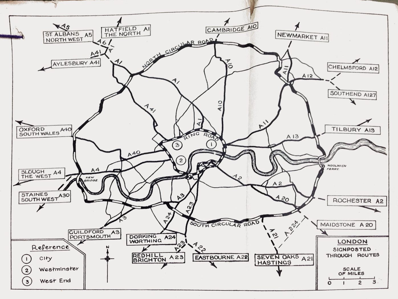
Until this time, signposting had happened ad hoc, with destinations chosen per-junction or per-road. For the first time, the Ministry of Transport chose a list of destinations and a method of indicating the places that might be reached by turning this way or that on ring roads, and then set about applying these decisions to the entire metropolis. All signposts would be replaced, many new ones would be added, and every last one would be erected with reference to the same plan. It may seem obvious today, but in 1950 this was a revolution.
All change
It soon became clear that the wholesale replacement of all London’s road signs presented opportunities to make other major changes as well, and the Through Routes project grew to include rerouting, reclassifying and designating new main roads on a remarkable scale.
Perhaps the most significant change was the reshaping of the North and South Circular Roads. To create a South Circular on existing streets, the A205 was sent west from Clapham through Wandsworth, Putney and Kew to meet the North Circular at Gunnersbury, while the North Circular was given an official routing south from Waterworks Corner to the Woolwich Ferry, completing the circle.
The Inner Ring Road was also a creation of this scheme. It had its genesis in a particularly successful element of the transport plan from the Festival of Britain: a special route for coach traffic to avoid Central London had been devised, circling Westminster and the City on Euston Road, Tower Bridge, Vauxhall Bridge and Park Lane. With a few adjustments to its route, it was made permanent. This makeshift orbital is still with us today, and now forms the Congestion Charge boundary.
Until 1951, road numbers didn’t always follow the most-used routes. The A1, for example, still ran through the middle of Finchley and Barnet, while its bypass was called A555. The Through Routes scheme attempted to put an end to this. Egregious numbering decisions of the 1920s were swept away, putting the A1 on the Barnet Bypass, the A40 on the Western Avenue and the A10 on the Great Cambridge Road, among others.
With the main roads chosen and the ring roads established, drawings were produced for new direction signs at all key junctions. The new signs would have bright yellow backing boards, to make them obvious and easily recognisable, and would all follow the same simple layout.
Finding the middle
Since new signs were to be installed all over London, and distances would have to be calculated for them all, the opportunity was taken to correct a quirk of history. Until 1951, London did not have a central point to which distances were measured.
Traditionally, there were actually seven such places, all related to the itineraries of mail coaches in centuries gone by. They were incredibly inconsistent, and only one was within a mile of Charing Cross. Depending on the direction of approach, distances might be measured from Marble Arch, Hyde Park Corner, Westminster Bridge, London Bridge, Whitechapel Church, Shoreditch Church or (perhaps the most obscure of all) the site of Hick’s Hall on St John Street, a building that had been demolished in 1778.
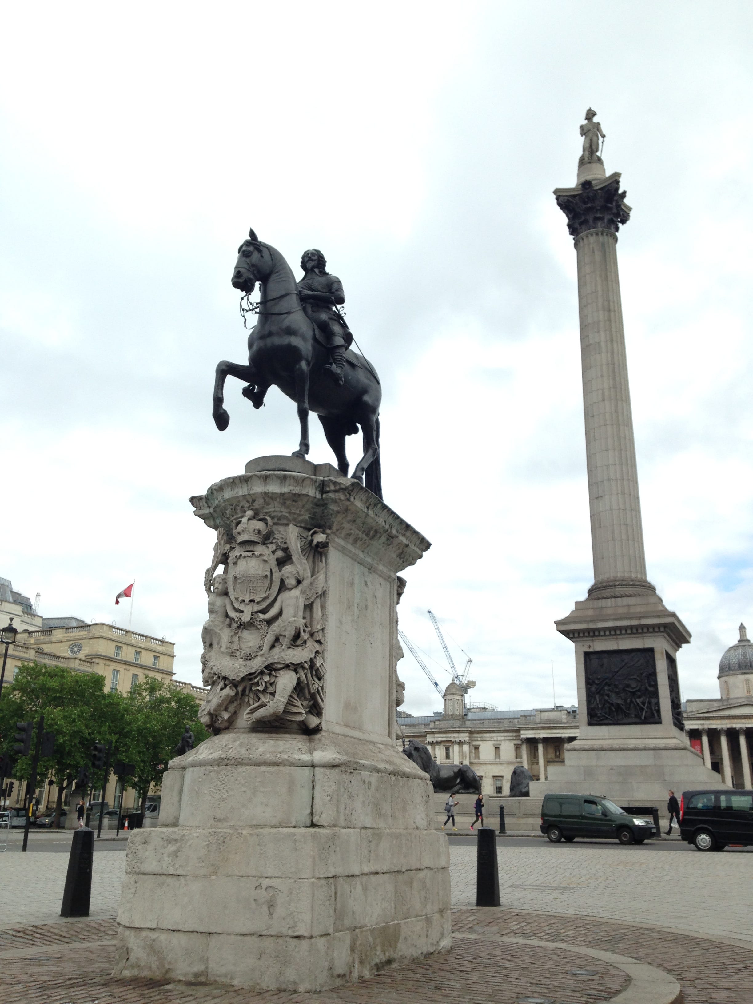
It might be expected that a rational decision to choose just one point would be welcomed, but in fact press coverage was decidedly mixed and there appeared to be some considerable affection for the old system. Nonetheless a new datum point was chosen - the statue of Charles I on the south side of Trafalgar Square, the original site of the Charing Cross. Westminster Council put a plaque on the site, still there today, which marks the significance of King Charles’ feet.
All mileages on the new signs – and indeed on all road signs erected in the capital since that time – have measured their distance to London from this point.
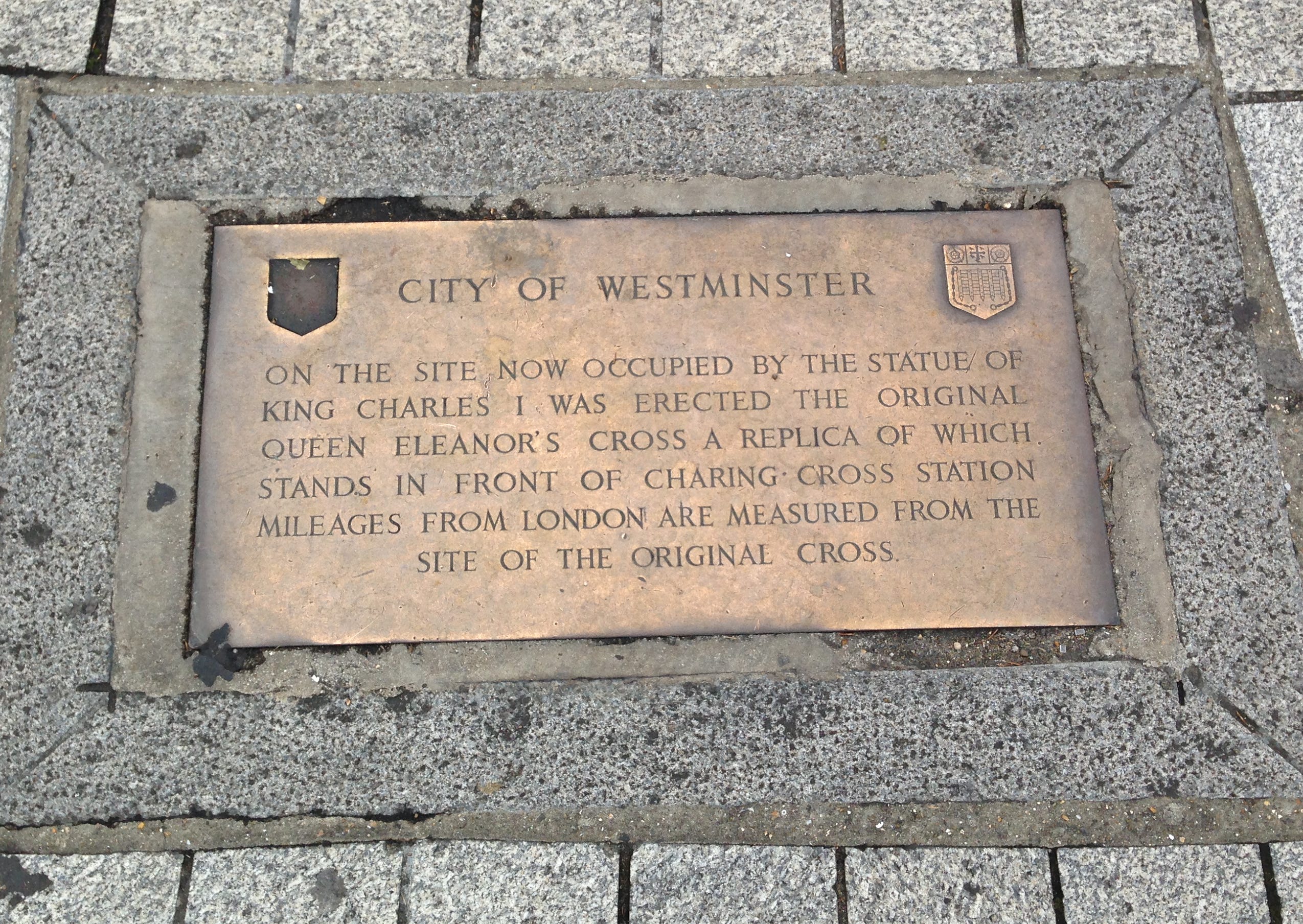
The Ministry didn’t elaborate on its reasons for selecting the statue on Trafalgar Square, but until that time it appears to have only been significant for one reason. In 1831, the London Hackney Carriage Act selected the statue as the centre point of the six-mile radius that defines The Knowledge. Motorists nationwide now count their distance from London with reference to Charing Cross, seemingly because that’s where London’s cab drivers consider the centre of the metropolis to be. Perhaps it was thought that there was no higher authority on the subject.
Spreading the load
In all, the Through Routes scheme was an attempt to redistribute traffic flows across Greater London to make journeys simpler and easier. Many of the Through Routes were created by commandeering existing streets, like Mortlake Road in Kew, which was elevated from a B-road to serve as the South Circular. Almost all of the roads used in this way were residential or fronted with shops and other premises.
It may seem odd that a peaceful street might be singled out to take heavy traffic, with signs erected to concentrate the flow of vehicles on one unlucky row of shops, pubs and houses. To do so would be unthinkable today. But in the early 1950s, it followed the established and accepted principle of “spreading the load” – easing the burden on existing main roads by drafting in other nearby routes to add to the available road space.
Time would prove that it was not a particularly effective or inclusive way of planning routes and roads. There was no right of reply for those who lived and worked on the streets that were affected. It was an approach that would be discredited in “Traffic in Towns”, Colin Buchanan’s 1963 report about the uncomfortable reality of attempting to remodel cities for the benefit of motor cars. But until Buchanan’s warnings were heard, London would continue to see hapless side streets used to create one-way streets and gyratories for its main roads – many of which remain in force today.
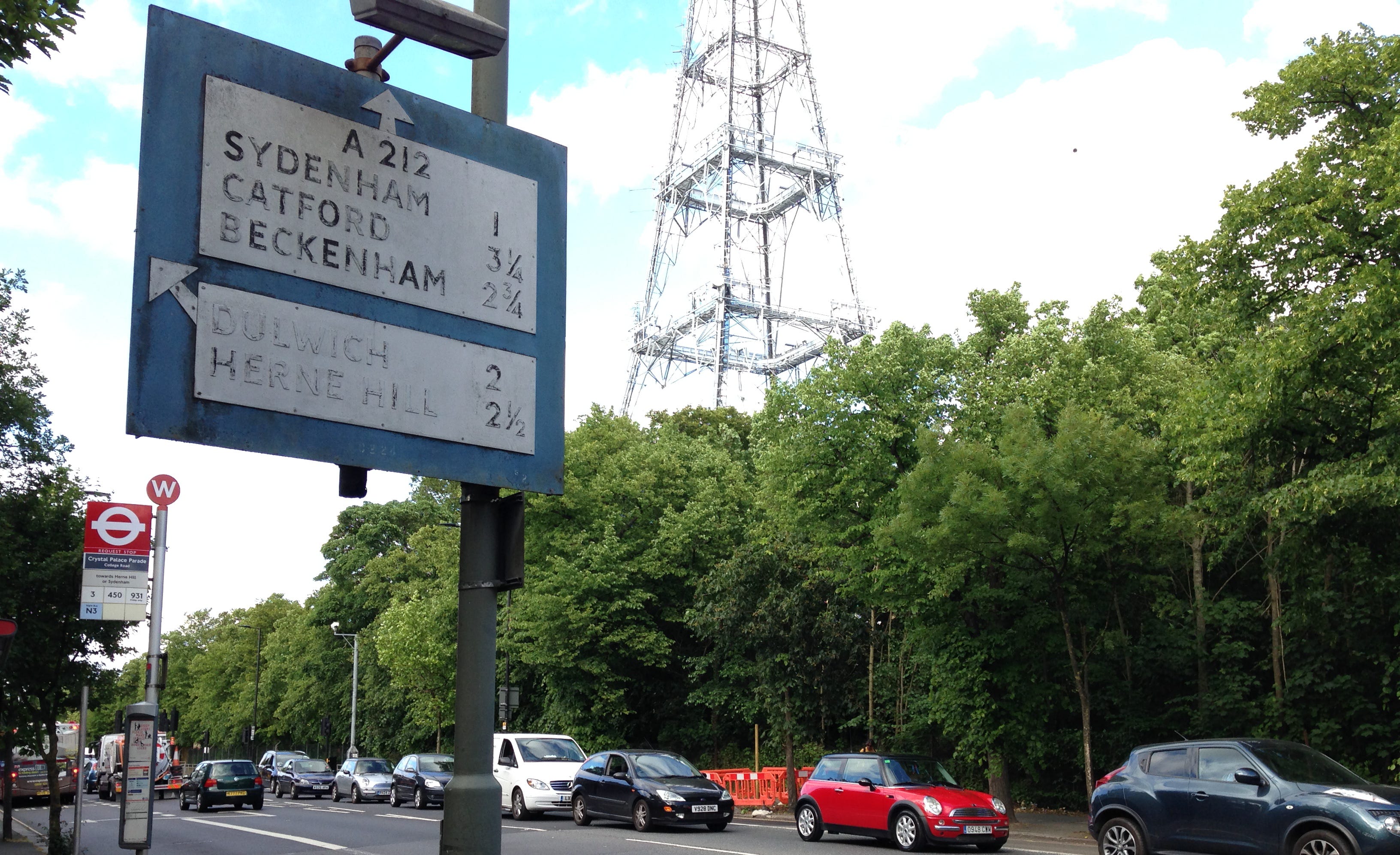
Despite initially being envisioned as a solution fit for the Festival of Britain, it was perhaps inevitable that, as the scope of the work grew, its delivery would slip. In the end, Alfred Barnes’ Through Routes scheme missed the Festival completely. Not that this missed deadline drew much notice – the Ministry was already firmly focused on not just providing yellow signs on main roads and ring roads, but also erecting a dense network of blue-backed local direction signs across the rest of London’s roads. The cost of the project was estimated at £140,000 in 1954, but at that point it still had another four years to run. The equivalent cost today would run into the tens of millions.
Out of Stepney
By 1957, the installation of yellow signs on main roads was almost complete, and about three quarters of blue signs were also up. Two hurdles remained.
One was the provision of blue signs in central London, an area that now had a definite boundary thanks to the Inner Ring Road. The signs there would follow the new and sensible idea that they should indicate road junctions and not localities, so as to be more specific. This policy is still used today; it’s why signs within the Inner Ring Road point to places like Parliament Square, Ludgate Circus and Bank.
The other hurdle was that there were no new signs at all in the Borough of Stepney.
Stepney’s Borough Engineer did not think much of Albert Barnes’ plan to make London navigable, and its belligerent Council Chamber made a great show of refusing to cooperate, insisting that there were more pressing demands on its finances in such a deprived inner-city location. The Ministry’s civil servants kept pushing them, but Stepney kept saying no.
“It would seem that the good citizens of Stepney subscribe very closely to the lesson of Matthew, Chapter VIII, Verse 39: ‘An evil and adulterous generation seeketh after a sign and there shall be no sign given to it.’”
- Civil Service memorandum, 1957
Without Stepney Borough’s assistance – and more importantly, without their share of the funding – there would be no signs in their part of East London, and the new Inner Ring Road was left with a confusing gap in its eastern side.
Stepney’s elected members and recalcitrant Engineer finally changed their mind in early March 1957, announcing that they would began work preparing their Borough’s new signposts. It is almost certainly the case that this did not represent a change of heart on Stepney’s part. Just a few days before, the Ministry of Transport had been granted the power by Parliament to force local authorities to erect road signs. The Borough had simply decided they would rather jump than suffer the indignity of being pushed.
A legacy of logic
The Through Routes of the 1950s were the first and last attempt to comprehensively review signposting across London and make its roads truly coherent.
Since then, newer signs have continued to use the destinations chosen in the 1950s, or more commonly, have simply copied old text onto a new sign. But most of them have been taken down at the end of their useful life and never replaced.
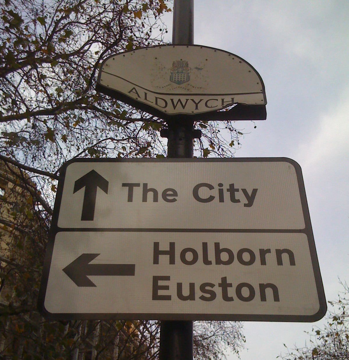
The only comparable project was a review of Primary Route signs in 1995, which systematically reviewed and replaced green signs on main roads across Greater London. Millions of pounds were spent, and the job was commendably thorough, but its designers would have to admit that they were still, to a considerable extent, relying on the groundwork laid in the fifties – going right back to the musings of a retired government chauffeur. On the TfL Red Route network these signs are kept up to date.
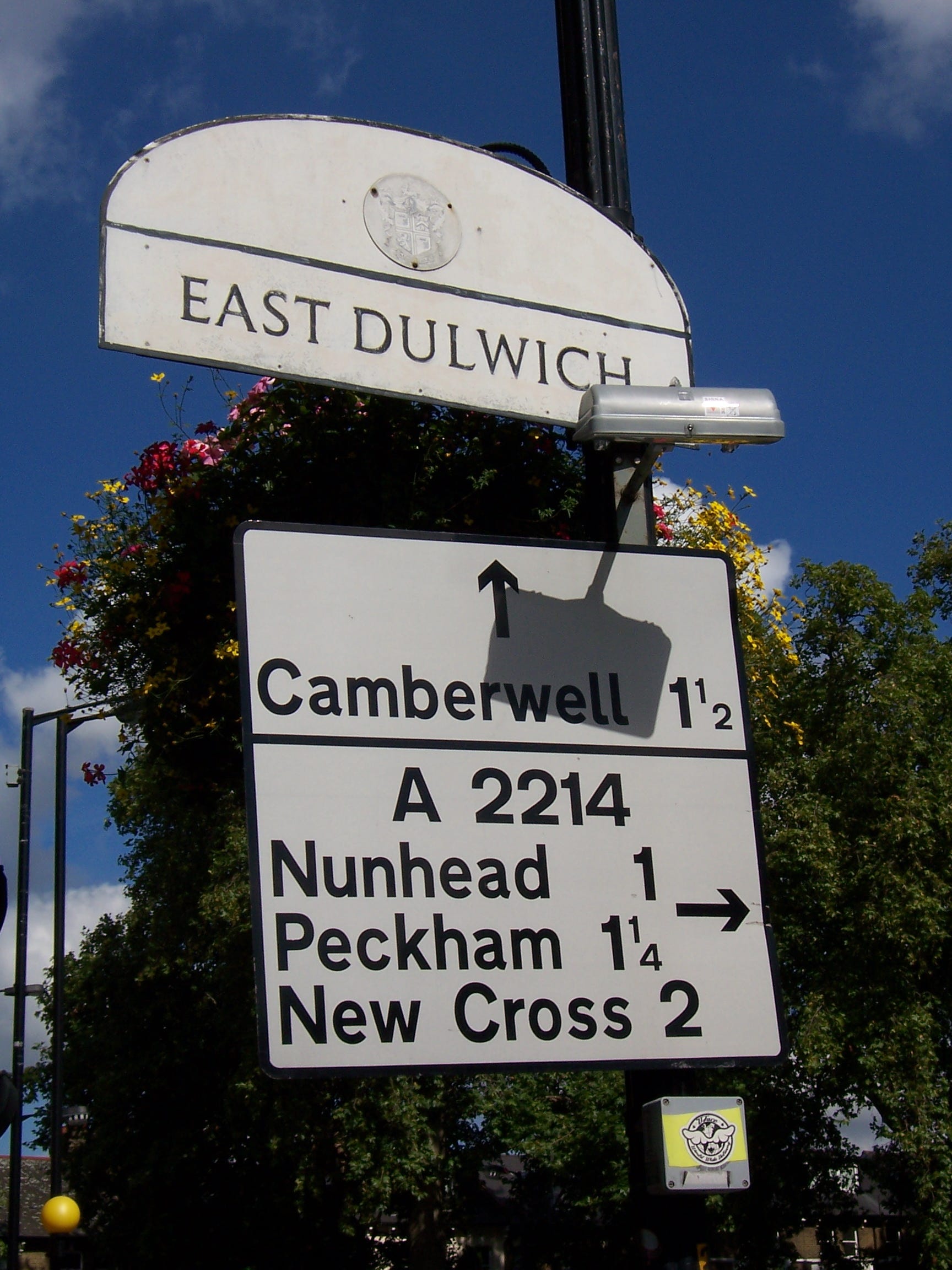
On minor roads, though, there has never been another review. The legacy of the blue Through Route signs is visible not just in the choice of destinations on modern black-and-white signs across London, but also in their layout, with some of London’s boroughs appearing to rely entirely on copying old signs. If you see a newer panel with a layout that seems unusual now, then it’s probably a misguided attempt to copy a Through Routes sign’s layout on the sign that has replaced it.
Often, though, those signs simply aren’t replaced at all.
Into the future
It would be easy to decry the decay. To lament this lack of central policy and prescription. But we no longer live in an era where heavy traffic can be redirected down previously quiet streets without protest. On streets that are already in use as main roads, the traffic is tolerated, but it would be undesirable to inflict the nuisance of heavy traffic onto another thoroughfare, and it would be even less acceptable to clear a path for a new purpose-built road to relieve it. Altering the status quo is thus rarely an option. If a review were to be conducted today it would, therefore, be forced to conclude that we should continue using broadly the same set of roads for the same purposes as we do already. Traffic engineers do not have the freedom (or indeed the lack of regard) needed to recast the flow of traffic as they did half a century ago.
Nor, in the world of satellite navigation, do signs perhaps hold the vital role that they used to. With instructions on everything from route to lane ordered by the device on the dashboard, it is marking temporary, rather than permanent routes that many drivers subconsciously see as the road sign’s primary role.
Nonetheless, navigation and wayfinding continues to be in everyone’s interests: not only is it a convenience for those who have to find their way through the streets, it’s also beneficial to everyone who lives and works in London. The view of the sat-nav is a simplistic one, and London is a complex city. One where channelling specific types of traffic onto the roads that match their purpose and limit their impact is going to become increasingly crucial if London is to continue to grow.
Indeed, even in the era of satellite navigation, CityMapper and Journey Planner, good direction signage continues to prosper in certain quarters. TfL and the boroughs continue to invest in street signs and kerbside maps for pedestrians in a project called Legible London; Cycle Superhighways are provided with clear and thorough signage - signs that are now sometimes the only ones present at a road junction. Heavy goods traffic continues to be channelized by the London-wide system of HGV restrictions. It can seem highly incongruous that clear directions for the benefit of all road users are not considered an equal priority and can even be treated with apathy by some of London’s boroughs.
But then, as this article has perhaps demonstrated, signposting has never really been fashionable nor a priority. So maybe it is best simply to be happy that, in the form of the Through Routes scheme, an enlightened and concerted effort to define navigation in London did once exist.
The mood may not have lasted and the evidence of that work is now mostly gone, but look closely enough, and its influence still remains.
You can read about the Arterial ‘A’ Ring in more detail on the main website, as part of my history of the Ringways.
Fascinating. I don't live in London, and visit increasingly rarely (and only by train, I'd never dream of driving in the city), but I really found that interesting.
Thank you
That was an amazing read. Thank you!